Author: pyoung64
New Google maps
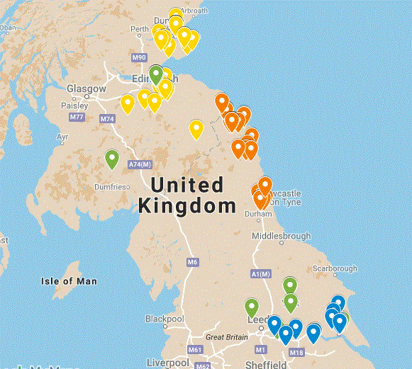
You will see that we have added a Google map showing all the direct ancestors for whom we have a place of birth – colour coded by the four families. It useful way into the individual family pages, and it’s interesting to see how clustered the families are. Not surprisingly there is less movement the further back in time we go – but still quite a bit.
The points on the map are all generated from 4 simple spreadsheets using the bulk layer load facility, so easy to update.
The exercise also unearthed a few of the quirks of Google maps. For example if it seems to assume a North American location if there’s a choice to be made, so giving Alice Martin (born 1747) an unexpectedly far flung place of birth in western Canada. However a correction to Thorne, South Yorkshire easily solved this one.
In a few cases a lat/long coordinates were used where the known place of birth was too obscure for Google maps, with a note of the place name.
Google maps doesn’t offer any historical base maps, but in a situation where we are looking at births over more than 200 years, there isn’t single set of maps that would be appropriate. There are a places where we have to approximate the location, e.g where a a 19th century street no longer exists, or the place of birth is just give as a large area, eg Edinburgh.
But overall very easy to use – the hard work was creating the spreadsheets.
